
የ12ኛ ክፍል ውጤት ወጥቷል፤ ውጤትዎን የሚያዩበት መንገድ

የምዕራፍ ማስታወሻዎችና የመልመጃ ጥያቄዎች

የ10ኛ ክፍል ጂኦግራፊ ምዕራፍ 3፦ የአፍሪካ የተፈጥሮ ሀብት መሠረት

በዚህ ገጽ ያለው ሁሉ ለ10ኛ ክፍል የጂኦግራፊ መፅሐፍ ምዕራፍ 3 ነው፦ ምዕራፉ የሚሸፍነው፣ አጭር ማስታወሻዎቹ፣ የመልመጃ ጥያቄዎች ከመልሶቻቸው ጋር፣ እና ቪዲዮ ባለበት የትምህርቱ ቪዲዮ።

ከ Google Play ያውርዱ
3
ካርዶች
10
የምዕራፍ 3 የመልመጃ ጥያቄዎች
48–80
የምዕራፍ 3 የመፅሐፍ ገጾች

ምዕራፍ 3 የሚሸፍነው

  1. 1.Overview of major natural resources of the world
  2. 2.Major drainage and water resources in Africa
  3. 3.Main types of soils and mineral resources in Africa
  4. 4.Major vegetation and wildlife of Africa

የምዕራፍ 3 አጭር ማስታወሻዎች

በ10ኛ ክፍል የጂኦግራፊ ገጽ ላይ በዚህ ምዕራፍ ሥር የተመዘገቡት ካርዶች። አንድ በአንድ ይክፈቱ።

የውሃ ምንጭከጠቅላላው ውሃ ድርሻከንፁህ ውሃ ድርሻ
የዓለም ውቅያኖስ (ጨዋማ)96.5%0.0%
ግላሲየሮች እና ቋሚ በረዶ1.74%68.7%
ንጹህ የከርሰ ምድር ውሃ0.76%30.1%
ጨዋማ ያልሆኑ ሐይቆች0.007%0.26%
ወንዞች0.0002%0.006%
የከባቢ አየር እና የባዮሎጂካል ውሃ0.0011%0.043%

መቼ እንደሚጠቀሙበት

የዓለምን የውሃ ክምችት ድርሻ ለማስላት እና የጨዋማና የንፁህ ውሃ መጠንን ለማነፃፀር ይጠቀሙ።

ይጠንቀቁ

ንፁህ ውሃ ከምድር ጠቅላላ ውሃ 2.5 በመቶ ብቻ ሲሆን፣ ከዚህ ውስጥ ከሁለት ሦስተኛ በላይ የሚሆነው በበረዶ ግግር ውስጥ የታሰረ እንጂ በወንዞች ወይም በሐይቆች ውስጥ ያለ አይደለም።

ከGrade 10 Geography፣ ገጽ 48-80 የተዘጋጀ፤ ከመውጣቱ በፊት ሁለት ጊዜ ተረጋግጧል

ተፋሰስርዝመትመዳረሻዋና ዋና ባህሪያት
Nile6,650 kmMediterranean Seaበዓለም ላይ ረጅሙ ወንዝ ነው። 86% የሚሆነው ውኃው የሚመነጨው ከ Ethiopia ነው።
Congo4,660 kmAtlantic Oceanበውኃ ይዘት በዓለም ሁለተኛው ትልቁ ነው። በ equatorial ፍሰት ምክንያት ዓመቱን ሙሉ ለ navigation ምቹ ነው።
Niger4,200 kmAtlantic Oceanበ Africa ሦስተኛው ረጅሙ ነው። Kainji Dam እና inland delta ይዟል።
Zambezi3,540 kmIndian OceanVictoria Falls እና Kariba Dam ይዟል። በመውጫው ላይ 60 km ስፋት ያለው delta አለው።
Orange2,092 kmAtlantic Oceanበ South Africa ረጅሙ ወንዝ ነው። Navigation በ silt፣ falls እና rapids ምክንያት ተዘግቷል።
ChadInland basinLake Chadበ Africa ትልቁ inland drainage ነው። ከፍተኛ evaporation የሚደርስበት ጥልቀት የሌለው ሐይቅ ነው።

መቼ እንደሚጠቀሙበት

ስድስቱን ዋና ዋና የአፍሪካ ወንዝ ተፋሰሶች፣ የፍሰት ባህሪያቸውን፣ መዳረሻቸውን እና ኢኮኖሚያዊ ጠቀሜታቸውን ለማነፃፀር ይጠቀሙ።

ይጠንቀቁ

የኮንጎ ወንዝ ተፋሰስ ከምድር ወገብ በሁለቱም በኩል ስለሚገኝ ዓመቱን ሙሉ ለትራንስፖርት ክፍት ነው፤ ሌሎች ወንዞች ግን በወቅታዊ የውሃ መጠን መቀነስ እና በፏፏቴዎች ይገደባሉ።

ከGrade 10 Geography፣ ገጽ 48-80 የተዘጋጀ፤ ከመውጣቱ በፊት ሁለት ጊዜ ተረጋግጧል
የአፈር ዓይነትሽፋንአፈጣጠር እና ባህሪያት
Arenosols22%አሸዋማ፣ በቀላሉ የሚሸረሸር፣ ዝቅተኛ የ nutrient የመያዝ አቅም ያለው። በአፍሪካ ውስጥ ዋነኛ አፈር፣ ለምሳሌ በ Kalahari ውስጥ።
Leptosols17%በጠጣር አለት ወይም ጠጠርማ ነገር ላይ የሚገኝ ጥልቀት የሌለው፣ ደካማ structure ያለው አፈር፣ በተራሮች እና በበረሃዎች ውስጥ የተለመደ።
Cambisols11%ግልጽ የሆኑ horizons የሌላቸው፣ በመጠኑ የጎለበቱ ወጣት አፈሮች፣ መጠነኛ የቀለም እና የ structure ልዩነቶችን የሚያሳዩ።
Ferralsols10%በጣም leached የሆኑ፣ በ iron እና aluminium oxides የበለጸጉ weathered አፈሮች፣ ቀይ እና ቢጫ ቀለም የሚሰጧቸው።
Calcisols6%ከፍተኛ የ calcium carbonate ክምችት ያላቸው አፈሮች፣ በደረቅ አካባቢዎች ጠጣር hard pan (calcrete) የሚፈጥሩ።

መቼ እንደሚጠቀሙበት

አምስቱን ዋና ዋና የአፍሪካ የአፈር አይነቶች፣ የሽፋን መጠናቸውን እና ኬሚካላዊ ወይም አካላዊ ባህሪያቸውን ለመለየት ይጠቀሙ።

ይጠንቀቁ

አሬኖሶልስ 22 በመቶ በመሸፈን በአፍሪካ ትልቁን ድርሻ ይይዛል፤ ፌራልሶልስ ቀይና ቢጫ ቀለም ቢኖራቸውም የማዕድን ይዘታቸው በጣም ዝቅተኛ ነው።

ከGrade 10 Geography፣ ገጽ 48-80 የተዘጋጀ፤ ከመውጣቱ በፊት ሁለት ጊዜ ተረጋግጧል

የምዕራፍ 3 የመልመጃ ጥያቄዎች

በዚህ ምዕራፍ ላይ የተጻፉ 10 የምርጫ ጥያቄዎች፣ እያንዳንዳቸው መልሱና ምክንያቱ አላቸው። መልሱን ከመክፈትዎ በፊት ይሞክሩ። ጥያቄዎቹ በእንግሊዝኛ ናቸው።

ጥያቄ 1

According to the textbook, what percentage of the Nile River water originates from Ethiopia?

  1. A.50%
  2. B.68%
  3. C.86%
  4. D.96%
መልሱንና ምክንያቱን ያሳዩ

መልስ፦ C 86%

ምክንያቱ

Ethiopia contributes 86% of the Nile water through right-bank tributaries such as the Abbay (Blue Nile), Baro, and Tekeze rivers.

ጥያቄ 2

Which soil type is the most dominant in Africa, covering about 22% of the continent's soils?

  1. A.Arenosols
  2. B.Leptosols
  3. C.Cambisols
  4. D.Ferralsols
መልሱንና ምክንያቱን ያሳዩ

መልስ፦ A Arenosols

ምክንያቱ

Arenosols are sandy soils with low nutrient-holding capacity. They cover 22% of Africa's total soil area, making them the continent's dominant soil type.

ጥያቄ 3

Which basin constitutes the largest inland drainage area in Africa?

  1. A.The Nile Basin
  2. B.The Congo Basin
  3. C.The Niger Basin
  4. D.The Chad Basin
መልሱንና ምክንያቱን ያሳዩ

መልስ፦ D The Chad Basin

ምክንያቱ

The Chad Basin forms the largest inland (endorheic) drainage area in Africa, centered around Lake Chad.

ጥያቄ 4

Which of the following is categorized as a renewable natural resource in the textbook?

  1. A.Coal
  2. B.Petroleum
  3. C.Wind energy
  4. D.Iron ore
መልሱንና ምክንያቱን ያሳዩ

መልስ፦ C Wind energy

ምክንያቱ

Wind energy and sunlight are renewable resources because natural processes replenish them as quickly as humans use them. Fossil fuels and mineral ores are nonrenewable.

ጥያቄ 5

Why does the Congo River maintain a stable flow throughout the year compared to other African rivers?

  1. A.Its flow is regulated entirely by giant meltwater glaciers
  2. B.Large sections of its basin lie both above and below the equator
  3. C.It flows entirely through the hyper-arid Sahara desert
  4. D.Artificial storage dams completely control its main channel
መልሱንና ምክንያቱን ያሳዩ

መልስ፦ B Large sections of its basin lie both above and below the equator

ምክንያቱ

Because large portions of the Congo Basin lie both north and south of the equator, at least one part of the river system is always experiencing a rainy season, keeping the water flow stable year-round.

ጥያቄ 6

Which African soil type is strongly leached, rich in iron and aluminum oxides, and recognized by its distinct red and yellow colors?

  1. A.Calcisols
  2. B.Ferralsols
  3. C.Leptosols
  4. D.Arenosols
መልሱንና ምክንያቱን ያሳዩ

መልስ፦ B Ferralsols

ምክንያቱ

Ferralsols are heavily weathered and leached soils found in high-rainfall areas. They are dominated by iron and aluminum oxides, giving them a strong red and yellow appearance.

ጥያቄ 7

Which country is identified in the textbook as Africa's largest producer of petroleum?

  1. A.Algeria
  2. B.Nigeria
  3. C.South Africa
  4. D.Gabon
መልሱንና ምክንያቱን ያሳዩ

መልስ፦ B Nigeria

ምክንያቱ

The textbook highlights Nigeria, located in West Africa, as the continent's largest petroleum producer.

ጥያቄ 8

Hydroelectricity is harnessed at Kariba Gorge on the Zambezi River along the border between which two countries?

  1. A.Zambia and Zimbabwe
  2. B.Ethiopia and Sudan
  3. C.Nigeria and Niger
  4. D.DR Congo and Uganda
መልሱንና ምክንያቱን ያሳዩ

መልስ፦ A Zambia and Zimbabwe

ምክንያቱ

The Kariba Dam harnesses hydroelectric power at the Kariba Gorge across the Zambezi River on the border between Zambia and Zimbabwe.

ጥያቄ 9

The Niger River, the third longest river in Africa, originates from which highland area?

  1. A.The Ethiopian Highlands
  2. B.The Futa Jalon highlands in Guinea
  3. C.The Drakensberg Mountains
  4. D.The Atlas Mountains in Morocco
መልሱንና ምክንያቱን ያሳዩ

መልስ፦ B The Futa Jalon highlands in Guinea

ምክንያቱ

The Niger River rises in the Futa Jalon highlands (mountains of Guinea) and flows approximately 4,200 km before emptying into the Atlantic Ocean through its delta in Nigeria.

ጥያቄ 10

According to the mineral reserves table in the textbook, South Africa possesses 91.3% of the world's reserves of which mineral?

  1. A.Manganese
  2. B.Chromium
  3. C.Platinum
  4. D.Gold
መልሱንና ምክንያቱን ያሳዩ

መልስ፦ C Platinum

ምክንያቱ

Table 3.2 shows that South Africa ranks first in global production of platinum and holds 91.3% of the world's known platinum reserves.

መተግበሪያው በዚህ ምዕራፍ ላይ 12 ጥያቄዎች አሉት፤ እየሠሩ ያርምዎታል። እዚህ ያሉት የመጀመሪያዎቹ 10 ናቸው።

የምዕራፍ 3 የመፅሐፍ ገጾች

ምዕራፍ 3 በየትምህርት ሚኒስቴር እትም ከገጽ 48 እስከ ገጽ 80 ይደርሳል።

የትምህርት ሚኒስቴር እትም, እንግሊዝኛ, 204 ገጾች

PDF ያውርዱ

ይህን ምዕራፍ በመተግበሪያው ይለማመዱ

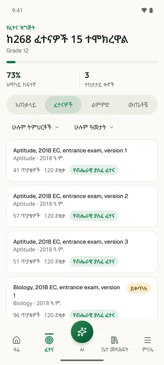
Temari ይህን ምዕራፍ ወደ ጊዜ የተቆረጠለት መልመጃ ይለውጠዋል፣ እየሠሩ ያርምዎታል፤ ያልገባዎትንም የሚያብራራ የ AI አስተማሪ አለ።

በነጻ ይጀምሩ

Temari.et ለ Android ስልኮች መተግበሪያ አለው፤ በ Google Play ላይ በነጻ ይገኛል።

ይግቡመለያዎን ይክፈቱ