የ10ኛ ክፍል ጂኦግራፊ ምዕራፍ 8
From a satellite scan to a finished map
1:28
የ10ኛ ክፍል ጂኦግራፊ ምዕራፍ 8 አጭር የ Temari የአኒሜሽን ማብራሪያ፦ From a satellite scan to a finished map። የሚናገረው ሁሉ ከቪዲዮው በታች ተጽፏል። በነጻ ይታያል፤ መለያ አያስፈልግም። ማብራሪያዎቹ በእንግሊዝኛ ናቸው።
ማብራሪያው የሚናገረው ሁሉ
የማብራሪያው ቃላት በየክፍሉ፣ በቪዲዮው ላይ እንደሚጻፉት።
Mapping from far away
Today, most mapping is done by remote sensing.
A satellite gathers data from far above, without touching the ground or visiting it.
It records elevation, land cover and temperature.
Satellites keep scanning, so maps of nearly the whole Earth stay up to date.
Raster: a grid of cells
These readings are raw data, the input, turned into a digital format.
One way to store them is raster. The area is cut into cells, by row and column.
Each cell takes the feature that covers most of it, so the lake becomes blue cells.
Vector: points, lines and areas
The other way is vector, built from coordinates.
A well is a point: one pair of coordinates, X and Y.
A river is a line, a string of points that ends at a node.
And a forest is an area, a closed ring of points.
Information comes out
A computer system called GIS stores, shows, analyses and interprets the data.
Mapmakers add a legend, a scale bar and a north arrow.
What comes out is information: data that has been processed and organised.
From data to a map
A satellite gathers the data, a computer stores it as raster or vector, and the map is information.
Save this one for revision.
የምዕራፍ 8 ሙሉ ትምህርት
በዚህ ምዕራፍ ላይ ያለው ረዘም ያለ የ Temari ቪዲዮ ትምህርት ነው፤ የሚናገረው ሁሉ በገጹ ላይ ተጽፏል።
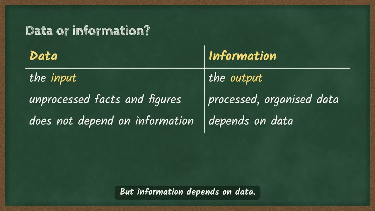 Data or information, and where map data comes from4 ደቂቃ
ስለ ምዕራፍ 8 ተጨማሪ
የምዕራፉ ገጽ Temari በዚህ ምዕራፍ ላይ ያለውን ሌላውን ይዟል፤ ለምሳሌ አጭር ማስታወሻዎችና የመልመጃ ጥያቄዎች ከመልሶቻቸው ጋር።
የምዕራፍ 8 ገጽ ይክፈቱይህን ምዕራፍ በመተግበሪያው ይለማመዱ
Temari ይህን ምዕራፍ ወደ ጊዜ የተቆረጠለት መልመጃ ይለውጠዋል፣ እየሠሩ ያርምዎታል፤ ያልገባዎትንም የሚያብራራ የ AI አስተማሪ አለ።
በነጻ ይጀምሩ
Temari.et ለ Android ስልኮች መተግበሪያ አለው፤ በ Google Play ላይ በነጻ ይገኛል።