
Bu'aan kutaa 12ffaa ba'eera; bu'aa kee eessatti akka ilaaltu

Yaadannoo boqonnaa fi gaaffii shaakalaa

Boqonnaa 8 Jiyoograafii kutaa 9: Dandeettii fi Mala Qorannoo Jiograafii

Wanti fuula kana irra jiru hundi boqonnaa 8 kitaaba Jiyoograafii kutaa 9 tiif: wanta boqonnaan haguugu, yaadannoo gabaabaa, gaaffii shaakalaa deebii isaanii waliin, fi viidiyoo barnootaa bakka jirutti.

Google Play irraa buufadhaa
3
Kaardii
10
Gaaffii shaakalaa boqonnaa 8

Boqonnaan 8 maal haguuga

  1. 1.Map and its basic components
  2. 2.Scale, scale conversion and measurements on
  3. 3.Position on maps
  4. 4.Map sketching
  5. 5.Interpreting maps and graphs

Yaadannoo gabaabaa boqonnaa 8

Kaardiiwwan fuula Jiyoograafii kutaa 9 irratti boqonnaa kana jala galmaa'an. Tokko tokkoon bani.

Gosa IskeeliiFiraakshinii Bakka Bu'aaBal'ina Lafa QabatuSadarkaa Bal'ina Odeeffannoo
Large Scale≥1:50,000\ge 1:50{,}000SmallHigh detail
Medium Scale1:50,000 to 1:250,0001:50{,}000 \text{ to } 1:250{,}000MediumModerate detail
Small Scale≤1:250,000\le 1:250{,}000LargeLow detail

Yoom akka itti fayyadamtu

Iskeeliiwwan kaartaa ramaduufi walitti dhufeenya reeshoo iskeelii, bal'ina lafaafi bal'ina odeeffannoo adda baasuuf itti fayyadami.

Of eeggadhu

Lakkoofsi waamtuu guddaa ta'e kan akka 1:1,000,000 iskeelii xiqqaa agarsiisa malee iskeelii guddaa miti.

Grade 9 Geography, fuula 202 irraa eegalee irraa qophaa'e; osoo hin ba'in dura yeroo lama mirkanaa'e

Yoom akka itti fayyadamtu

Kaartaa gariidii qabu irratti qindoomina dijitii afuriifi jahaa iddoo tokkoo adda baasuuf seera kanatti fayyadami.

Of eeggadhu

Yeroo hunda sararoota bahaa (Eastings) sararoota kaabaa (Northings) dura dubbisi, faallaa isaa hin godhin.

Grade 9 Geography, fuula 202 irraa eegalee irraa qophaa'e; osoo hin ba'in dura yeroo lama mirkanaa'e

Gosa KaabaaHiikaKaartaa Irra Kan Jiru
True NorthKallattii meridian irraan gara Geographic North Pole geessuSararoota Longitude (meridians)
Magnetic NorthKallattii lilmoo magnetic compass tiin agarsiifamuLilmoo magnetic compass
Grid NorthKallattii sararoota grid vertical gara oliitti agarsiisaniiEastings (sararoota grid vertical)

Yoom akka itti fayyadamtu

Kaartaa dubbisuufi kofa kallattii safaruuf hiikawwan kallattii kaabaa sadan gargar baasuuf itti fayyadami.

Of eeggadhu

Sararoonni gariidii sarara giddugaleessaa tokkicha qofa irratti malee Kaaba Dhugaa hin agarsiisan.

Grade 9 Geography, fuula 202 irraa eegalee irraa qophaa'e; osoo hin ba'in dura yeroo lama mirkanaa'e

Gaaffii shaakalaa boqonnaa 8

Gaaffii filannoo 10 boqonnaa kana irratti barreeffaman, tokkoon tokkoon isaanii deebii fi sababa qabu. Deebii banuu dura yaali. Gaaffiin kun Ingiliffaa tiin.

Gaaffii 1

What is the main function of the legend (or key) on a map?

  1. A.It explains the meaning of the signs and symbols used on the map.
  2. B.It tells the user the exact year the map was printed.
  3. C.It names the organization and city that published the map.
  4. D.It indicates the exact direction of the geographic North Pole.
Deebii fi sababa agarsiisi

Deebii: A It explains the meaning of the signs and symbols used on the map.

Sababa

The legend or key explains the meaning of all signs, colors, and symbols used by the map-maker to represent physical and human features.

Gaaffii 2

By standard cartographic convention, which direction is usually placed at the top of a map?

  1. A.South
  2. B.East
  3. C.North
  4. D.West
Deebii fi sababa agarsiisi

Deebii: C North

Sababa

By convention, map makers place the North direction at the top of maps using a North arrow or orientation indicator.

Gaaffii 3

Which instrument is used to measure the accurate area of both regular and irregular shapes directly from a map?

  1. A.Planimeter
  2. B.Magnetic compass
  3. C.Pair of dividers
  4. D.Protractor
Deebii fi sababa agarsiisi

Deebii: A Planimeter

Sababa

A planimeter is a mechanical device used to get accurate area measurements of both regular and irregular shapes from maps.

Gaaffii 4

A map with a scale greater than or equal to 1:50,000 is classified as a:

  1. A.Small-scale map
  2. B.Medium-scale map
  3. C.Large-scale map
  4. D.Continental map
Deebii fi sababa agarsiisi

Deebii: C Large-scale map

Sababa

Maps with scales of 1:50,000 or larger (such as 1:20,000 or 1:10,000) are large-scale maps. They show small areas in high detail.

Gaaffii 5

If a map has a Representative Fraction (RF) scale of 1:500,000, what is this scale expressed as a scale statement?

  1. A.1 cm to 5 km
  2. B.1 cm to 50 km
  3. C.1 cm to 0.5 km
  4. D.1 cm to 500 km
Deebii fi sababa agarsiisi

Deebii: A 1 cm to 5 km

Sababa

Since 1 km = 100,000 cm, divide 500,000 by 100,000. This gives 5 km, meaning 1 cm on the map represents 5 km on the ground.

Gaaffii 6

On a map drawn to a scale of 1:800,000, the straight-line distance between two Ethiopian towns is 4 cm. What is the actual ground distance between them?

  1. A.20 km
  2. B.32 km
  3. C.40 km
  4. D.320 km
Deebii fi sababa agarsiisi

Deebii: B 32 km

Sababa

Ground Distance = 4 cm × 800,000 cm = 3,200,000 cm. Dividing 3,200,000 cm by 100,000 gives 32 km.

Gaaffii 7

In the National Grid Reference system, what are the vertical grid lines that are numbered eastwards from the grid origin called?

  1. A.Northings
  2. B.Parallels
  3. C.Eastings
  4. D.Azimuths
Deebii fi sababa agarsiisi

Deebii: C Eastings

Sababa

Vertical grid lines on a national grid map are numbered eastwards from the origin and are called eastings. Horizontal lines are called northings.

Gaaffii 8

If the angular bearing from point A to point B is 135°, which compass direction does this represent?

  1. A.Northeast (NE)
  2. B.Southeast (SE)
  3. C.Southwest (SW)
  4. D.Northwest (NW)
Deebii fi sababa agarsiisi

Deebii: B Southeast (SE)

Sababa

Compass bearings start at North (0°) and move clockwise: East is 90°, Southeast is 135°, South is 180°, and West is 270°.

Gaaffii 9

A rectangular plot of grazing land measures 3 cm in length and 2 cm in width on a map with a scale of 1:250,000. What is the real ground area of the land?

  1. A.15.0 km<sup>2</sup>
  2. B.25.0 km<sup>2</sup>
  3. C.37.5 km<sup>2</sup>
  4. D.75.0 km<sup>2</sup>
Deebii fi sababa agarsiisi

Deebii: C 37.5 km<sup>2</sup>

Sababa

At 1:250,000, 1 cm = 2.5 km. Ground length = 3 cm × 2.5 km = 7.5 km. Ground width = 2 cm × 2.5 km = 5 km. Area = 7.5 km × 5 km = 37.5 km2.

Gaaffii 10

Unlike a four-digit grid reference, a six-digit grid reference gives a position accurate to the nearest:

  1. A.10 meters
  2. B.100 meters
  3. C.1 kilometer
  4. D.10 kilometers
Deebii fi sababa agarsiisi

Deebii: B 100 meters

Sababa

A six-figure grid reference provides location accuracy to the nearest 100 meters, which is possible on larger scale maps. A four-figure reference is accurate to the nearest kilometer.

Appiin boqonnaa kana irratti gaaffii 12 qaba; utuu hojjettuu ni sirreessa. Kan asii jiran 10 jalqabaa ti.

Fuula kitaabaa boqonnaa 8

Kitaaba barataa Jiyoograafii kutaa 9 guutuu, PDF bilisaan.

Maxxansa Ministeera Barnootaa, Ingiliffaa, Fuula 247

PDF buufadhaa

Boqonnaa kana appii keessatti shaakali

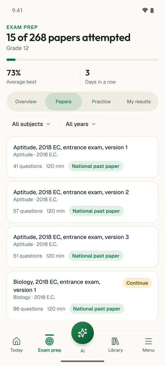
Temari boqonnaa kana gara shaakala yeroon daangeffametti jijjiira; utuu hojjettuu ni sirreessa; wanti si hin galinis barsiisaa AI tiin ni ibsama.

Bilisaan jalqabi

Temari.et appii Android qaba; Google Play irratti bilisaan argama.

SeeniHerrega kee bani